


Voting District 10888, Los Angeles County, California
About
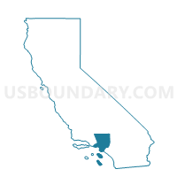
Outline

Summary
| Unique Area Identifier | 532572 |
| Name | Voting District 10888 |
| County | Los Angeles County |
| State | California |
| Area (square miles) | 0.01 |
| Land Area (square miles) | 0.01 |
| Water Area (square miles) | 0.00 |
| % of Land Area | 100.00 |
| % of Water Area | 0.00 |
| Latitude of the Internal Point | 34.03978590 |
| Longtitude of the Internal Point | -117.98536290 |
Maps


Graphs
Select a template below for downloading or customizing gragh for Voting District 10888, Los Angeles County, California


Neighbors
Neighoring Voting District (by Name) Neighboring Voting District on the Map
- Voting District 10010, Los Angeles County, CA
- Voting District 10822, Los Angeles County, CA
- Voting District 10882, Los Angeles County, CA
Top 10 Neighboring County Subdivision (by Population) Neighboring County Subdivision on the Map
Top 10 Neighboring Place (by Population) Neighboring Place on the Map
Top 10 Neighboring Unified School District (by Population) Neighboring Unified School District on the Map
- Hacienda La Puente Unified School District, CA (116,563)
- Bassett Unified School District, CA (26,667)